Summary
| DATE | 09/01/2023 |
| ORIGIN TIME | 17:47:34.8 UTC |
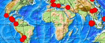
| LOCATION | -7.049 130.038 |
| DEPTH | 105 km |
| MAGNITUDE | 7.6 |
| LOCALITY | MALUKU,INDONESIA |
Epicentre is approximately 110 km WNW of the Tanimbar Islands, 520 km ENE of Dili, East Timor and 600 km north of Darwin, Australia. No reports of damage or casualties have been received. Based on historical earthquake and tsunami data NO destructive tsunami warning has been issued, however, there is the possibility of a local tsunami that could affect coastal areas close to the epicentre.