Summary
| DATE | 28/01/1878 |
| ORIGIN TIME | 11:53:00 UTC |
| LOCATION | 49.800 -0.600 |
| DEPTH | 16.0 km |
| MAGNITUDE | 5.0 ML |
| LOCALITY | NORMANDY |
| DATE | 28/01/1878 |
| ORIGIN TIME | 11:53:00 UTC |
| LOCATION | 49.800 -0.600 |
| DEPTH | 16.0 km |
| MAGNITUDE | 5.0 ML |
| LOCALITY | NORMANDY |
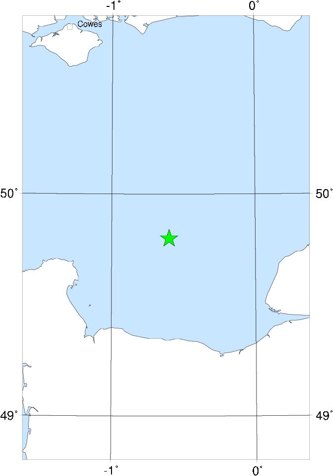

This event was felt over much of Normandy, in the Channel Islands, and more weakly along the south coast of England and about as far north as London. It was also felt in Paris. The epicentre was offshore, N of Caen. No damage is reported. It seems likely that there was at least one substantial foreshock and aftershock.