Summary
| DATE | 07/06/2026 |
| ORIGIN TIME | 23:37:42.3 UTC |
| LOCATION | 5.592 125.047 |
| DEPTH | 55 km |
| MAGNITUDE | 7.8 |
| LOCALITY | MINDANAO,PHILIPPINES |
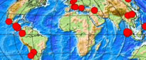
Epicentre was 30 km SSW Glan and 60 km south of General Santos City. At least 82 people were killed (with 31 still missing), over 1300 others were injured and over 70,000 buildings were destroyed or damaged across many provinces in Mindanao. A tsunami was generated with a maximum wave height of 1.48 m recorded at Kiamba. The mainshock was followed by a magnitude 6.5 aftershock around 78 minutes later.