Observational Methods
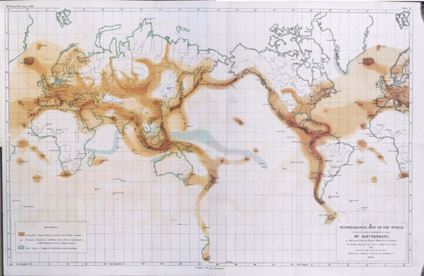
The earliest attempts at seismic hazard assessment were simple, and based on compiling observations on what had gone before. At the lowest level, this amounted to compiling a map of earthquakes and discriminating those areas with a lot of earthquakes from those with few.
The next step was to look at the actual effects of earthquakes in terms of intensity distributions. One can compile a map showing the maximum observed intensity over the historical period. Such maps are still quite useful today as a means of showing what has happened in the past. But they necessarily don't give any information as to what might happen if an earthquake should occur which is not a repeat of a historical earthquake.
One approach which has been followed quite often in the past is to take the maximum observed intensity and add a safety margin, such as plus one intensity degree.