Summary
| DATE | 26/02/1575 |
| ORIGIN TIME | 17:00:00 UTC |
| LOCATION | 53.200 -1.600 |
| DEPTH | km |
| MAGNITUDE | 5.0 ML |
| LOCALITY | MIDLANDS |
| DATE | 26/02/1575 |
| ORIGIN TIME | 17:00:00 UTC |
| LOCATION | 53.200 -1.600 |
| DEPTH | km |
| MAGNITUDE | 5.0 ML |
| LOCALITY | MIDLANDS |
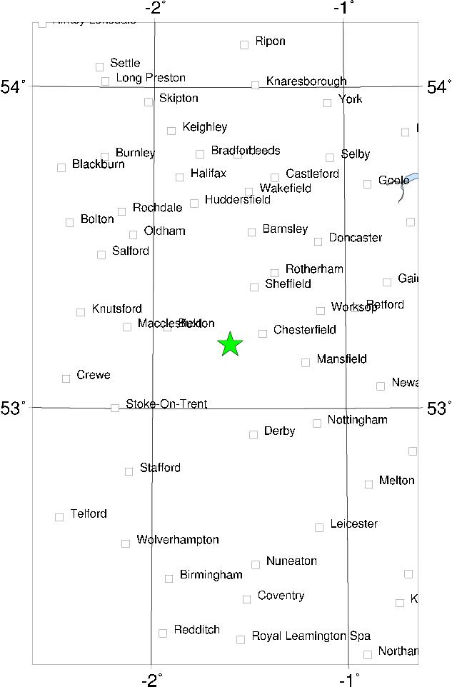

Even though the data for this earthquake are fairly good compared to most of the previous events, locating the epicentre is rather difficult. The earthquake was felt at York, Hatfield (near Doncaster), Ruthin, Denbigh, Tewkesbury, Bredon, Hereford, Gloucester and Bristol. At Ruthin, Denbigh and Tewkesbury the intensity was at least 5 MSK, but the most damage was at and near Hatfield in Yorkshire. At this place some old houses and barns were thrown down and part of the gable end of the manor house fell. Near Hatfield, supposedly, churches were "laid flat with the ground" and "great damage was done in all the country over". If the epicentre was near Doncaster, the distribution of the remaining reports is rather eccentric. More likely the epicentre was in the Midlands, in the Derby/Stafford area.
Sources: BGS material.