Summary
| DATE | 19/07/1727 |
| ORIGIN TIME | 04:00:00 UTC |
| LOCATION | 51.570 -3.760 |
| DEPTH | 25.0 km |
| MAGNITUDE | 5.2 ML |
| LOCALITY | SWANSEA |
| DATE | 19/07/1727 |
| ORIGIN TIME | 04:00:00 UTC |
| LOCATION | 51.570 -3.760 |
| DEPTH | 25.0 km |
| MAGNITUDE | 5.2 ML |
| LOCALITY | SWANSEA |
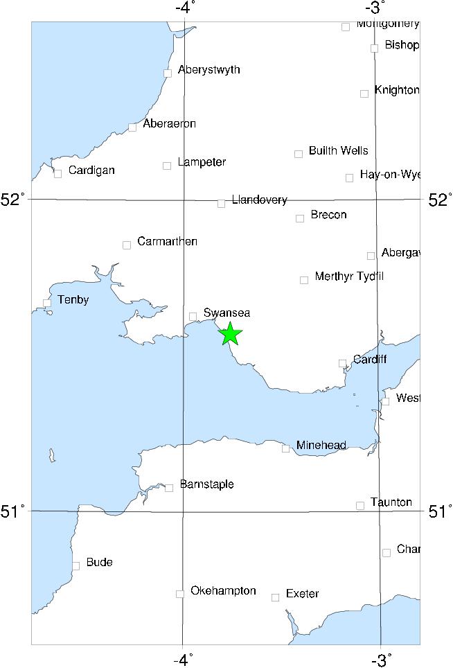

The epicentre of this earthquake was east of Swansea, near Margam. The intensity was higher at Margam than elsewhere, and this was the only place where aftershocks were reported. Chimnies were thrown down, houses were untiled, and the water of the local river was rendered turbid.
The shock was strong enough to wake people and to cause bells to toll as far east as Oxford, and the shock was also felt very slightly in London. The westward limits of the shock are obscure; one report refers to it being felt "beyond the sea" which may indicate Ireland. The shock was strong in Devon, and was also felt in Lancashire.
It is possible that some of the reports of this event are somewhat exaggerated, since the size of the isoseismal 5 MSK as given here is rather large as compared to the overall felt area.
Sources: Musson et al (1984a).