Summary
| DATE | 17/03/1843 |
| ORIGIN TIME | 00:55:00 UTC |
| LOCATION | 53.920 -3.790 |
| DEPTH | 17.0 km |
| MAGNITUDE | 5.0 ML |
| LOCALITY | IRISH SEA |
| DATE | 17/03/1843 |
| ORIGIN TIME | 00:55:00 UTC |
| LOCATION | 53.920 -3.790 |
| DEPTH | 17.0 km |
| MAGNITUDE | 5.0 ML |
| LOCALITY | IRISH SEA |
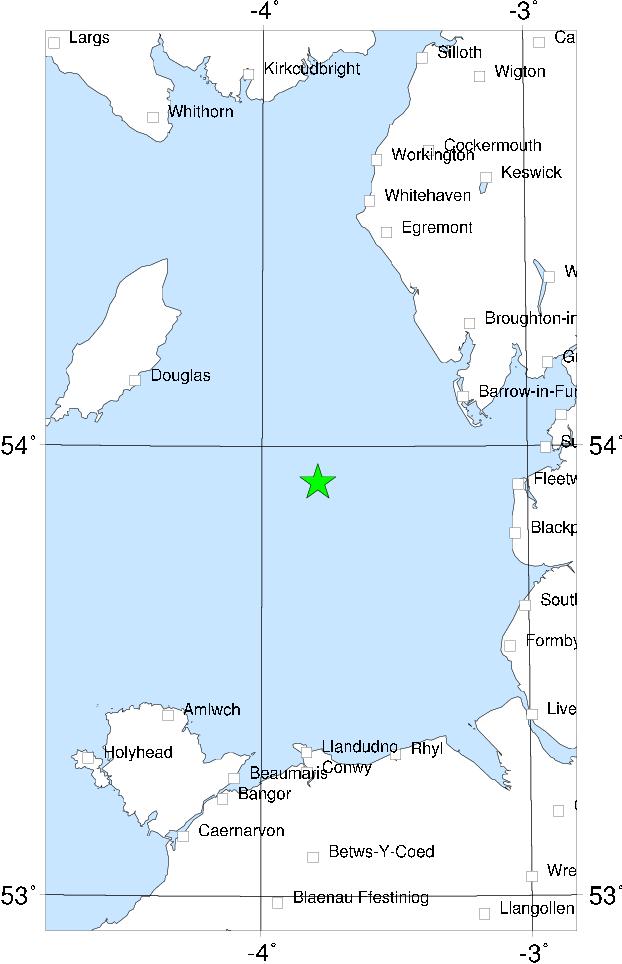

The epicentre of this earthquake was actually offshore, somewhere to the west of Barrow-in-Furness. The earthquake was felt throughout most of Northern England, in S Scotland, N Wales and along the east coast of Ireland from Belfast to Dublin. The only damage reported was from Castletown in the Isle of Man, where ceilings were damaged. The shock was quite strongly felt in Lancashire and the east coast of Cumbria; there are reports of objects falling, furniture moving, considerable alarm, but no damage. The shock was also felt on board ships in the Irish Sea.
Sources: Burton et al (1984).