Summary
| DATE | 30/05/1889 |
| ORIGIN TIME | 20:19:00 UTC |
| LOCATION | 49.400 -0.600 |
| DEPTH | 25.0 km |
| MAGNITUDE | 5.2 ML |
| LOCALITY | NORMANDY |
| DATE | 30/05/1889 |
| ORIGIN TIME | 20:19:00 UTC |
| LOCATION | 49.400 -0.600 |
| DEPTH | 25.0 km |
| MAGNITUDE | 5.2 ML |
| LOCALITY | NORMANDY |
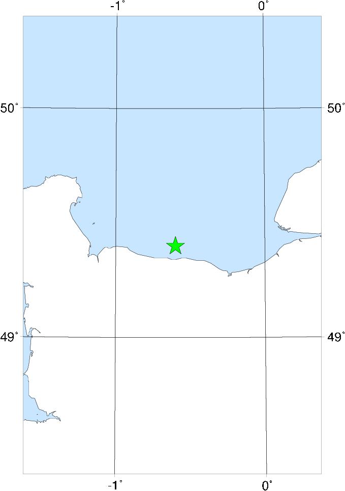

This earthquake was felt over a very wide area of N France and S England. In England it was perceptible from Penzance to London, and one isolated report comes from as far north as near Worcester. In France the eastern limit was Paris, but the western limit is uncertain. Slight damage is reported from both sides of the Channel - at Cherbourg and Lisieux in France and at Portsmouth in England. The shock was quite strong in the Channel Islands. The epicentre was probably just off the N coast of France, between Cherbourg and Caen.