| DATE | 17/2/2018 |
| ORIGIN TIME | 14:31:07.6 UTC |
| LOCATION | 51.767 -3.833 |
| DEPTH | 7.5 km |
| MAGNITUDE | 4.6 ML |
| LOCALITY | CWMLLYNFELL |
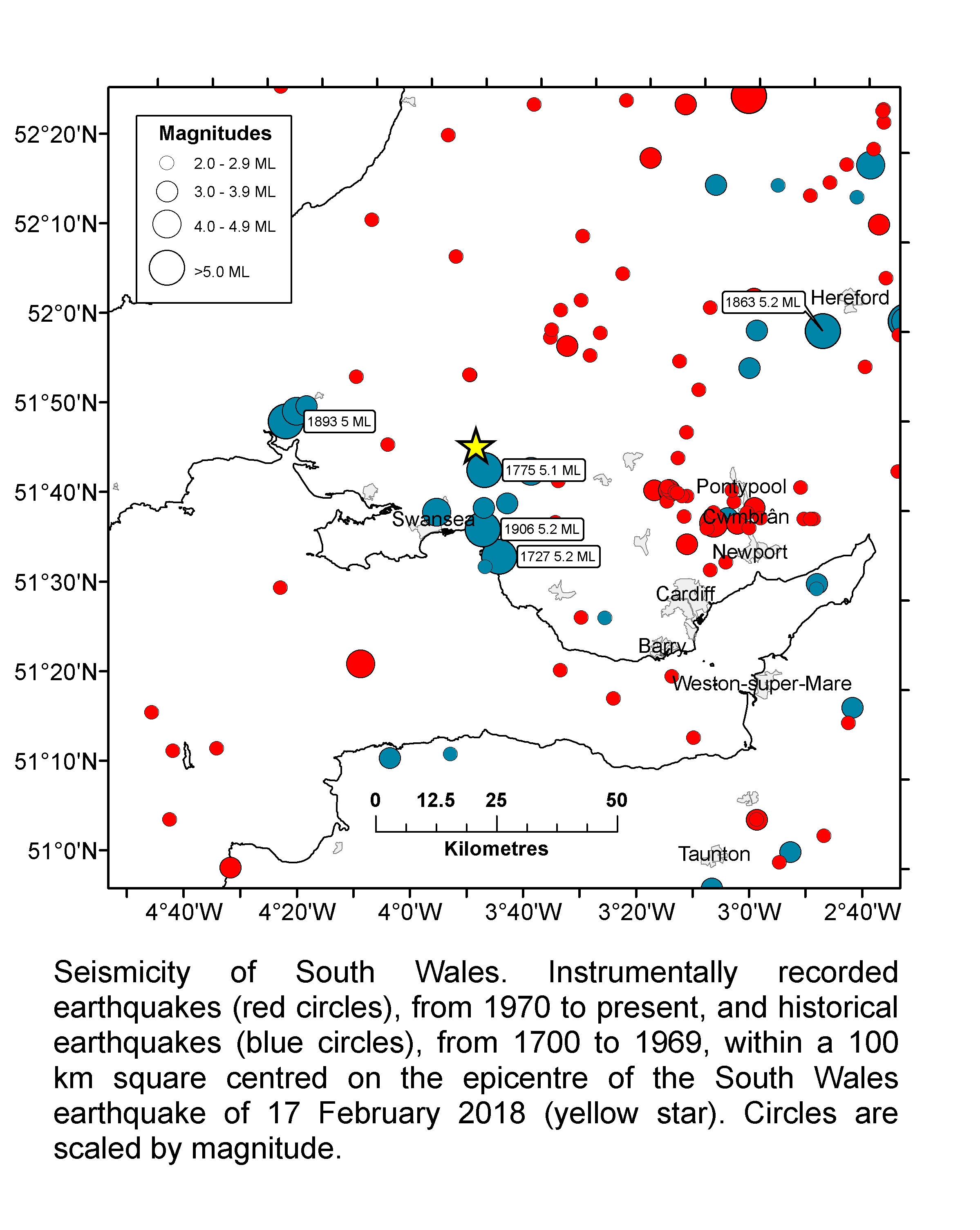
This is the largest earthquake on mainland Britain in almost 10 years, since the magnitude 5.2 ML Market Rasen earthquake on 27 February 2008. The earthquake occurred in a part of south Wales that has been struck by a number of other significant earthquakes in the last few hundred years. A magnitude 5.2 ML earthquake in 1906 was one of the most damaging British earthquakes of the 20th Century, with damage to chimneys and walls reported from Kidwelly to Cardiff. Earthquakes with magnitudes of 5.2 and 5.1 occurred near Swansea in 1727 and 1775 respectively. BGS received reports of the earthquake being felt from several thousand people. The maximum observed intensity was 5 EMS, which corresponds to strong shaking. The earthquake was felt over much of Wales and southwest Britain. An earthquake of this size occurs somewhere on mainland Britain roughly every 4 years. In 2014, a magnitude 4.1 earthquake occurred in the Bristol Channel and was widely felt in south Wales and Devon.